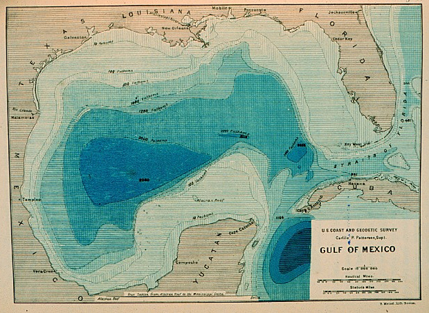
This map is a Bathymetric map and it is very similar to a Topographic map but the difference is it for water. Bathymetric Maps show the depth and different elevations of water. These maps are very important to show people the different levels of water and where the changes occur. In this particular map, the white color is very shallow water and as the blue color gets darker, the water level gets deeper.
No comments:
Post a Comment